
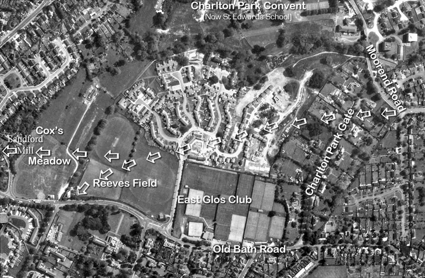
 Arrows indicate the approximate route of the pre-1780s 'Old London Road' from Sandy Lane/Moorend Road on the right of this 1982 aerial photograph across Charlton Park to Old Bath Road and Sandford Mill on the left.
 © Gloucestershire Archives
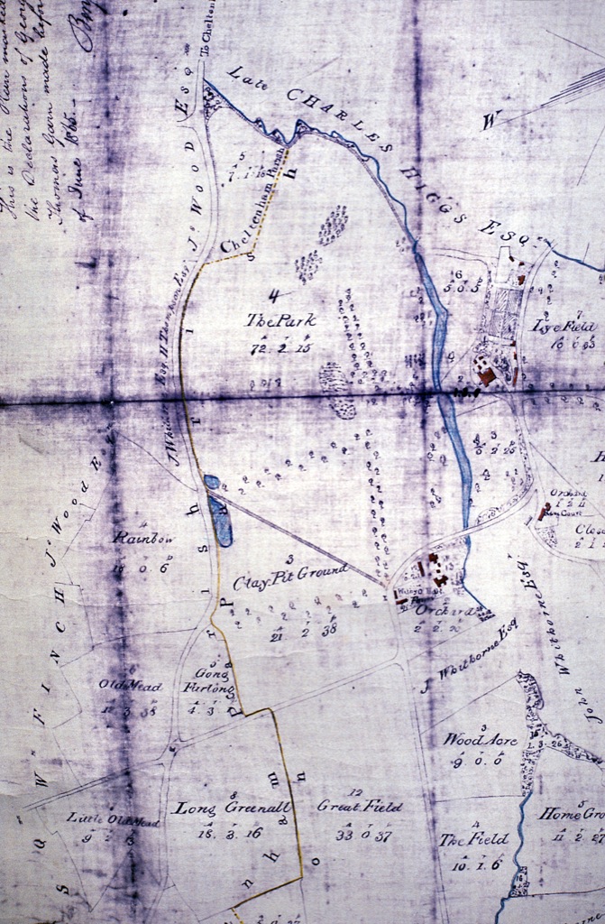
The 1811 estate map of Charlton Park (72 acres) with the mansion shown as a red block, upper right.
Clay Pits Path (there in 1784) is a public footpath today between Moorend Road and Old Bath Road.
Clay Pit Ground provided clay for some of the bricks used to cover W H Prinn's timber framed house.
The water filled pits were filled in by the 1920s/30s as more modern houses were built on Old Bath Road.The vertical avenue of trees to the left of the mansion and lakes follows the route of the Old London Road and theavenue running left-to-right across the park, the carriage-road seen in Thomas Robins' c1740 painting (on page 24)