
 © Gloucestershire Archives
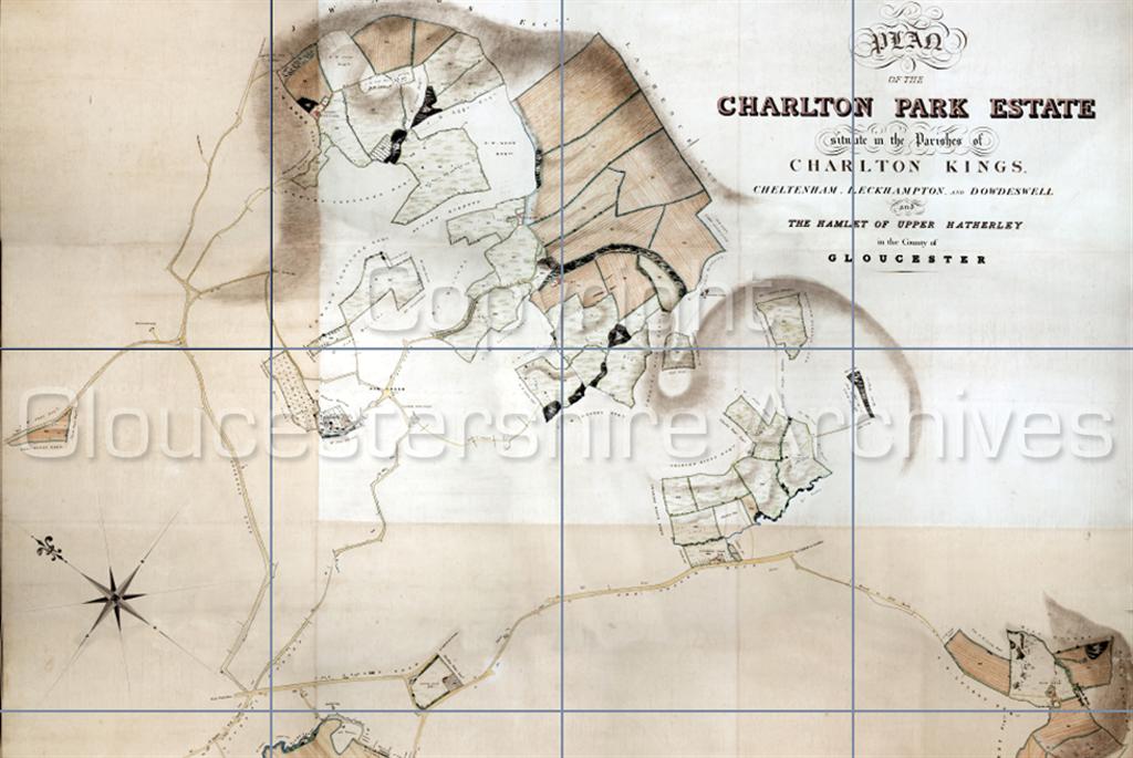
Charlton Park's 1843 Estate Map (upper half) including the estate's outlying farms.
 © Gloucestershire Archives
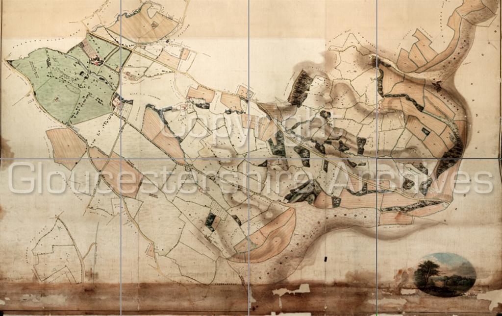
Charlton Park's 1843 Estate Map (lower half) showing the park and its mansion in upper left corner, together with more of the estate's outlying farms, with a vignette of the park in the lower right corner.Sandy Lane (Old London Road) was diverted right at Withyholt Farm some 60 years before this map was made. The newer 'Moorend Road' now runs along the east edge of Charlton Park - which is shaded green on the map.
 © Gloucestershire Archives
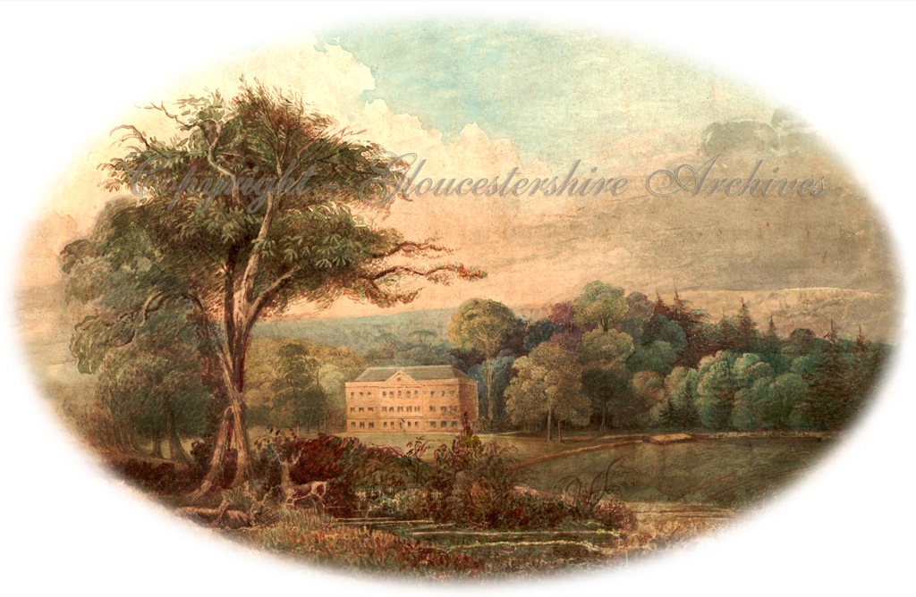
Vignette of the mansion in Charlton Park from the 1843 estate map.
The house was known as 'Forden House' until about 1784The avenue of trees fading into the distance on the left (where the stags and hind are) appear to be on the course of old Sandy Road which crossed the park until closed in the 1780s.
♦
NB. Surprisingly Charlton Park's mansion house was never known as Charlton Park House
and it should not be confused with a modern dwelling called Charlton Park House on the north side of the nearby private road called Charlton Park Gate, built 1935 onwards.♦