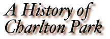
 © N B PringleNorden's Survey of Cheltenham c1617 with Charlton Park to the east of the town (confusingly on the left of his map).
Diagonal lines have been added by the author to show the location of Charlton Park and its old mansion.Charlton Kings is still called Charlton Regis at this stage.
[We can explain roads from Cheltenham to London here. The 'Old London Road' on Norden's Survey (above) and the same'Old London Road' on Mitchell's Map (below) crossed Charlton Park, passing Withyholt Farm to go up Sandy Lane. This is not the more north-easterly route we call 'London Road' today, which was routed from Cheltenham through Charlton Kings (East End) and onwards to London via Northleach and Oxford].
There are of course as many routes along which to venture when probing the development of this beautiful town and its environs as there were once well-trodden footpaths linking all the contiguous hamlets and villages. Most attempts to describe things historic have concentrated on the old market town of Cheltenham and its more recent expansion into a notable Regency Spa Town. This is frequently the case with post-1788 accounts in local history books. Several refer to the satellite villages of Leckhampton, Hatherley, Prestbury, Swindon and Charlton Kings as they struggle to maintain a semblance of historic individuality against today's relentless urban creep. Former hamlets, such as Alstone, Arle, Naunton, Sandford and Westall, have long since been swallowed up as Cheltenham expanded to become the predominant hub in this local network. So, whilst the history of former hamlets and peripheral villages has featured in print in a number of books, with the possible exception of Mary Paget's 'A History Of Charlton Kings' and Local History Society bulletins (available in the library) little reference was made to Charlton Park. Bequething this minor contribution to the e-annals of local history is my attempt to further redress the balance, hoping others may carry it forward when the time comes for me to hand it on.
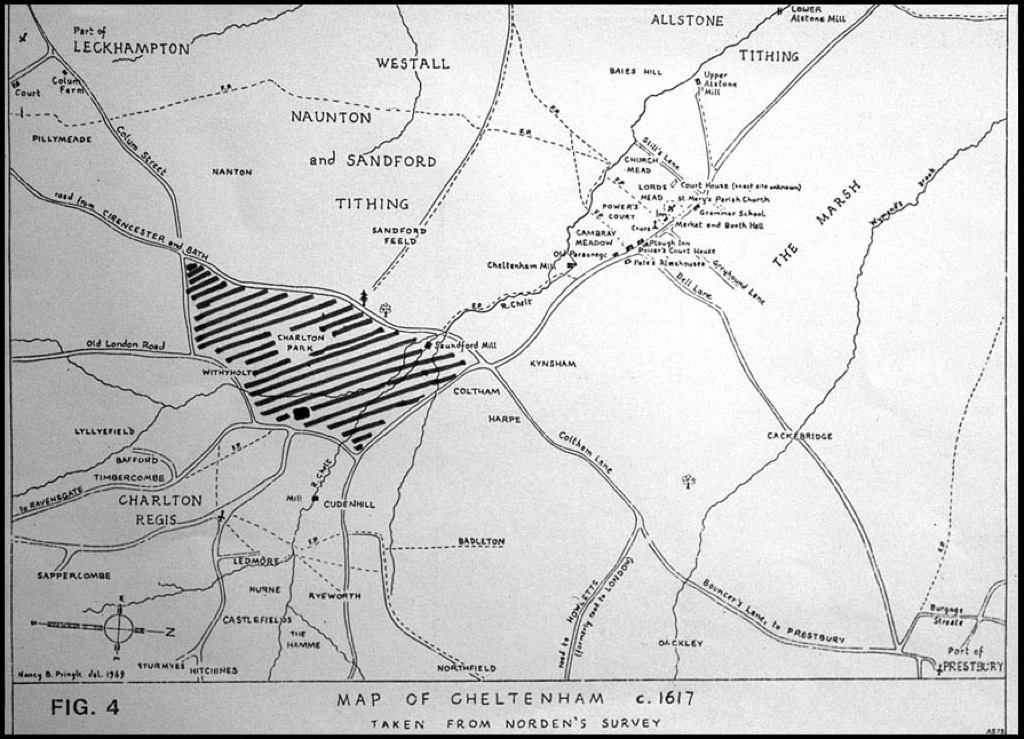
 © Gloucestershire ArchivesCoates' 1776 delineation of Cheltenham, just 12 years beforeKing George III stayed here, putting the town firmly on the map.
Charlton Park adjoins the left edge of Coates' map and 'exploding' the picture may enable you to read 'Road to Cirencester' on the upper track pointing to the left edge of the map-frame; Mr Coates having written it upside down on his map! It branched off Old Bath Road, slightly above today's junction with Sandford Road, crossing Charlton Park towards Sandy Lane (Old London Road) and is said to have been a primary eighteenth century (and much earlier) route used by people visiting the developing town from as far as London and Cirencester.
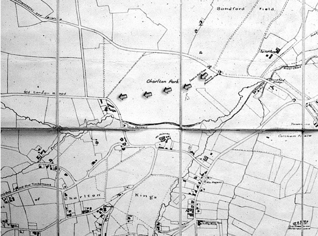 © David HanksMitchell's map of 1806.
On Mitchell's 1806 map arrows have been added by the author to indicate the approximate route of Cheltenham's long-lost 'Old London Road' through Charlton Park during earlier centuries. Charlton Park's old mansion is shown as 'Mr Prinns' on the map, just below the centre-fold. The Lilley Brook passed through Charlton Park and then meandered through the centre of [what became] Cox's Meadow, joining the River Chelt by Sandford Mill and bridge.