
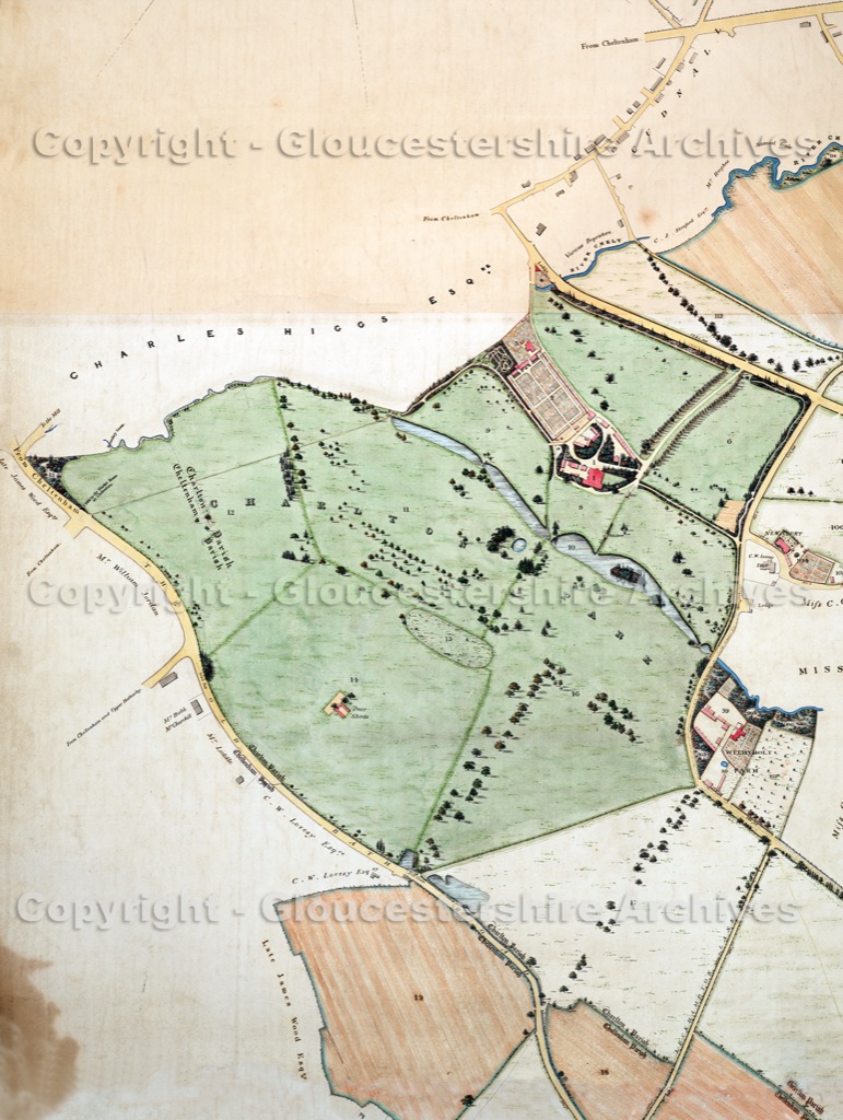
 © Gloucestershire ArchivesCloser view of the 'Old Park' section of the impressive 1843 Estate Map.On the 'Home' page the 1982 aerial photograph allows you to see features like the 'Deer Sheds' in-situ, under 'East Glos Club' .The photograph overlays the 1843 map quite accurately, enabling you to place other lost features such as former lakes and gardens.From where Sandy Lane turns right at Withyholt a feint trace of its former route across Charlton Park is just detectable in the trees.
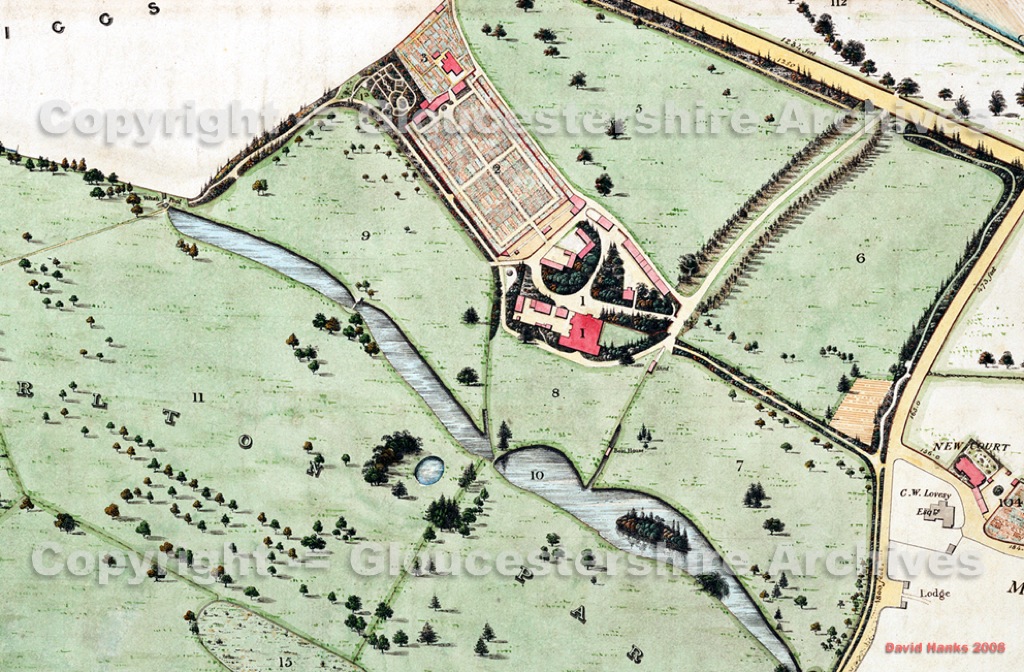 © Gloucestershire ArchivesCloser view of the 1843 Estate Map showing the mansion, the walled kitchen garden and water features in Charlton Park.
Note the small pool in the tree lined bowl on the lower (south-west) side of the lakes, which will be mentioned later.
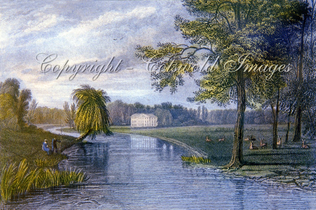 © Cotswold Images1820s engraving - the artist was most likely on Mr Prinns (1709/10) stone-bridge which crosses Lilley Brook between Withyholt Farm and New Court on today's Moorend Road.See right side of the upper 1843 map (above) and lower edge of 1885 map (next page)